River Adur
Jump to navigation
Jump to search
These are some research notes for a future Yank in Sussex video about the River Adur.
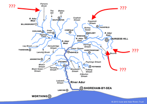
I have a question about the "source" of the Adur. I've seen it written (Wikipedia, etc) that the source of the Adur is near Slinfold. Based on the catchment diagram to the right, however, I have some questions:
- Why is the western branch of the Adur considered the primary branch, where the "source" is found?
- My observation: From the catchment map, it appears that the eastern branch is actually longer than the western, and it appears that the Copyfold stream ends further away from the Adur's map than the western branch's at Slinfold. Do we have actual distance measurements for this?
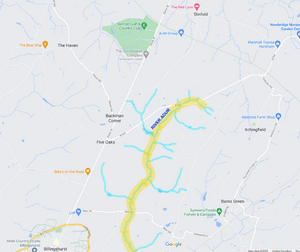
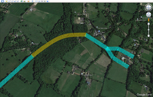
- The western branch ends in a fork, both tines of which seem to be the same length. Which tine is the "true" source?


